
Looking for the Best Hikes Near Las Vegas?
Are you in the Las Vegas region, looking to escape the city and find the best places to hike nearby!? Look no further because there are plenty of places to explore in the Mojave Desert! If you want to explore outside the metropolitan area, this post covers sixteen fantastic hiking trails within driving distance!
16 Best Hikes near Las Vegas: An Overview
Las Vegas is an extremely popular vacation destination that’s great for entertainment, food, and culture. It’s also located in the heart of the Mojave Desert, which has fantastic hiking opportunities for outdoor enthusiasts! Don’t forget to bring your best desert hiking boots for your Vegas trip because there are a variety of spots for you to explore!
Mary Jane Falls Trail
Mary Jane Falls Trail is one of the most popular trails within the Vegas region for its tranquil and outstanding waterfalls. This hike is known for its sweeping views as you summit a ridge and overlook the beautiful waterfall. The path is well maintained, but steep and occasionally slippery from rainfall.
This trail is only open seasonally from April to December and is closed from January through March. It’s currently closed until further notice due to storm damage (January 2024). Check their website for more information on the status of trail closures.
Location: Mount Charleston Wilderness
Distance: 3.3 miles
Route type: Out & Back
Elevation gain: 1,036 feet
Difficulty: Moderately challenging
Average time to complete: 2 – 3 hours
Calico Tanks Trail

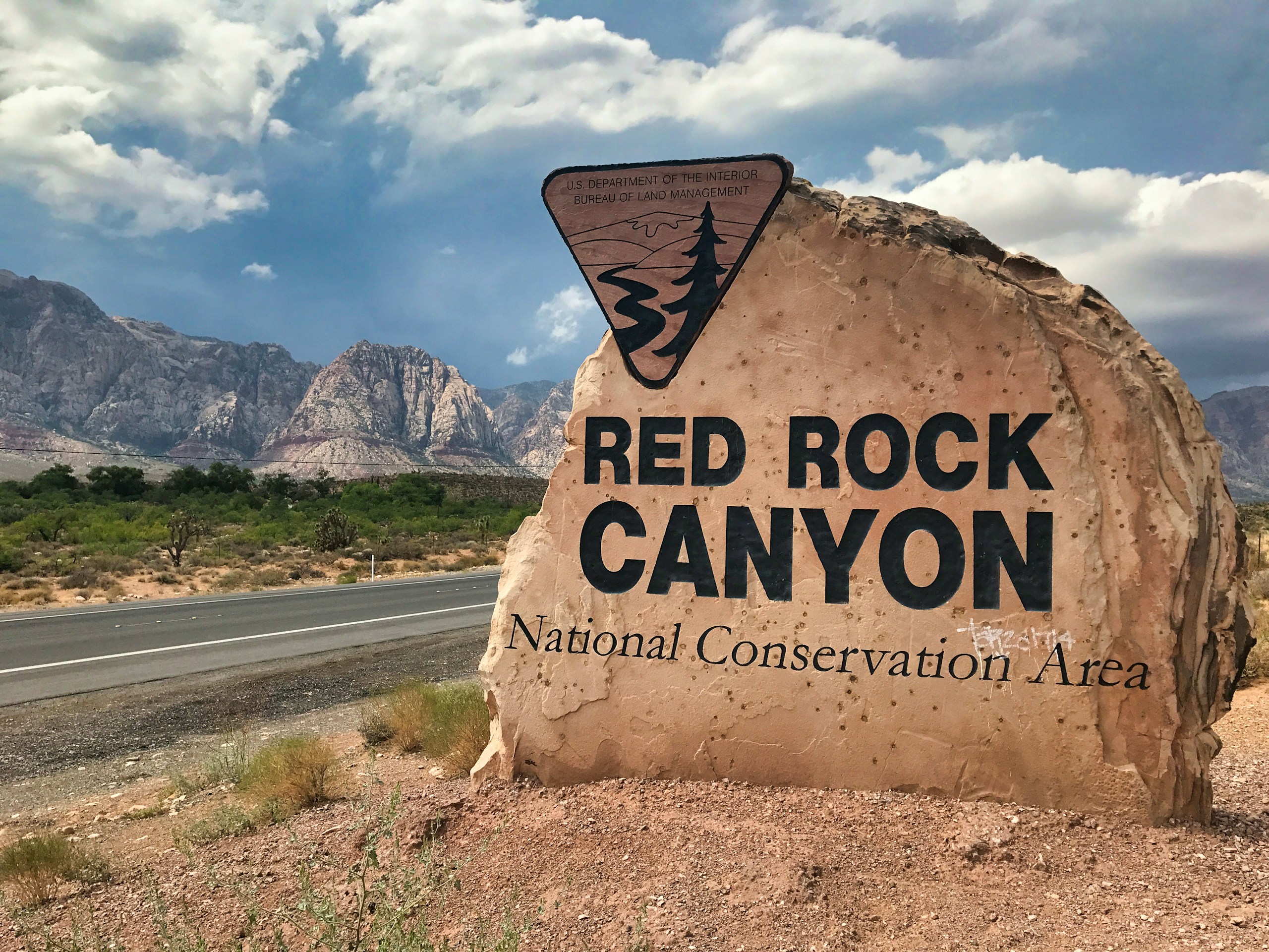
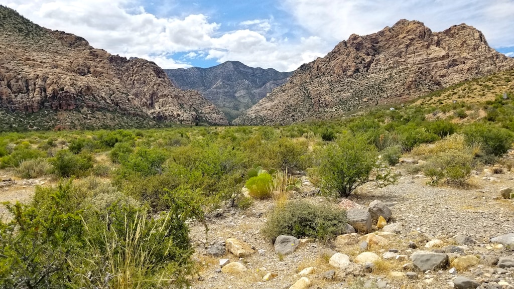
Red Rock Canyon is a breathtaking conservation area located near Blue Diamond, Nevada. Calico Tanks Trail is a popular hiking trail due to its gorgeous sandstone formations against the backdrop of rolling hills. You’ll also get a glimpse of Las Vegas and see Calico Tank off in the distance!
Take note that Red Rock Canyon has implemented a reservation system for its scenic drive, and reservations are required from October 1st to May 31st. There is a primary booking window up to 30 days in advance and a secondary booking window two days in advance. Check their website for more information.
Location: Red Rock Canyon National Conservation Area
Distance: 2.4 miles
Route type: Out & Back
Elevation gain: 439 feet
Difficulty: Moderately challenging
Average time to complete: 2 hours
Ice Box Canyon Trail
The Ice Box Canyon trail is a great hike for those who enjoy the road less traveled. This trail brings visitors along Ice Box Canyon to a marvelous waterfall at the end. There are many different opportunities along the way to explore different pinnacles and peaks.
An important thing to note about this trail is that is considered a scramble for most of the way. You’ll navigate larger rocks along the canyon and some have noted that it is a primitive trail that is not well maintained. It’s recommended to download the map for offline use so that you can stay on track!
Location: Red Rock Canyon National Conservation Area
Distance: 2.1 miles
Route type: Out & Back
Elevation gain: 439 feet
Difficulty: Moderately challenging
Average time to complete: 2 hours
Fire Wave Trail

Fire Wave is personally my favorite trail within the Vegas region because the views are truly out of this world! It’s a fairly sandy trail that takes you through windy red and white sandstone, giving a fiery feel. This is a nice and easy hike and it’s great for beginners, though I’d still recommend some sturdy hiking boots to navigate the terrain!
Valley of Fire charges a fee to enter the park, but Nevada residents will receive a discount. Once inside, there’s a fantastic gift shop/visitors center that includes a ton of great information on the park. Check the website for seasonal trail closures from May to September due to the extreme heat.
Location: Valley of Fire State Park
Distance: 1.3 miles
Route type: Out & Back
Elevation gain: 150 feet
Difficulty: Easy
Average time to complete: 30 mins – 1 hour
White Domes Loop Trail

Another great hiking trail in Valley of Fire State Park is White Domes Loop. Located just thirty minutes northeast of the strip, this is a geological wonder you’ll for sure want to check out. White Domes Loop takes you through the erotic white and red sandstone as you wind through a slot canyon with towering rocks on each side.
Valley of Fire is a sight to behold as the landscape starkly contrasts the colors of the sky. The volcanic structures are truly captivating and leave you amazed by nature’s laws. It’s recommended to visit sometime other than the summer, as this state park can get extremely hot!
Location: Valley of Fire State Park
Distance: 1.1 miles
Route type: Loop
Elevation gain: 177 feet
Difficulty: Easy
Average time to complete: 30 mins – 1 hour
Cathedral Rock Trail
Cathedral Rock Trail is a great hike if you’re looking to escape the Mojave Desert heat. You’ll wind through an aspen and pine forest, traverse past Echo Cliffs, pass a small spring, and eventually scale up Cathedral Rock. There are plenty of sights to see on the way up, but be aware that this is a steep incline, especially with the switchbacks towards the top!
This trail is currently closed from the damage of Hurricane Hilary that occurred in October of 2023 for public safety (January 2024). Check the US Forest Service’s website for more information on trail closures and updates.
Location: Spring Mountains National Recreation Area
Distance: 2.8 miles
Route type: Out & Back
Elevation gain: 948 feet
Difficulty: Moderately challenging
Average time to complete: 1.5 hours
Willow Springs Loop
If you’re looking for an easy yet beautiful hike to get away from Vegas for a bit, Willow Springs Loop is a great option. The trail loops through Rocky Gap Road and the Scenic Loop Drive, and if you go during the right season, you’ll find a flowing waterfall along the trail. It can be a little rocky and steep in some locations, so keep that in mind when you go!
Location: Red Rock Canyon National Conservation Area
Distance: 1 mile
Route type: Loop
Elevation gain: 134 feet
Difficulty: Easy
Average time to complete: 30 minutes
Pine Creek Canyon Trail
The abundance of flora, fauna, and views make this an extremely rewarding trail in Red Rock Canyon! This scenic route follows a canyon through a pine forest, providing lush scenery in an otherwise arid desert landscape. Enjoy the sounds of the creek on your way for a peaceful meandering morning, afternoon, or evening.
Some hikers have difficulty locating this trail as it is not well-marked. Additionally, it’s recommended to wear long pants as some of the vegetation is overgrown on the trail. It’s recommended to visit during the cooler months.
Location: Red Rock Canyon National Conservation Area
Distance: 2.4 miles
Route type: Out & Back
Elevation gain: 259 feet
Difficulty: Easy
Average time to complete: 1 hour
La Madre Springs Trail
If you’re looking for a slight challenge where you’ll find an abandoned cabin and sweeping vistas, the La Madre Springs trail is the trail for you. Follow this steep trail up the mountain and across the creek up to La Madre Peak for a hike of a lifetime. The trail may be overgrown and rocky, so keep that in mind before choosing this route!
The abandoned cabin is often accompanied by overnight backpackers who have obtained a permit. Make sure to be respectful of the historical landmark, and leave it as it is! It is illegal to remove or disturb anything in the area.
Location: Red Rock Canyon National Conservation Area
Distance: 3.6 miles
Route type: Out & Back
Elevation gain: 728 feet
Difficulty: Moderately challenging
Average time to complete: 2 hours
Gold Strike Canyon Hot Springs Trail
Looking for a trail near Vegas where you can swim at the end? Look no further than Gold Strike Canyon Hot Springs Trail – a strenuous trek through a marvelous canyon where you’ll end up at a cluster of hot spring pools. This may be a challenging hike, though it’s worth it for the natural hot tubs that await you.
This hike is steep and includes challenging fixed ropes to help you navigate boulders and rock steps. At some points in the trail, there is blue paint that shows you the direction of getting down some steep parts. Water temperatures vary between the river and various pools, so there’s a swimming spot for everyone!
Location: Lake Mead National Recreation Area
Distance: 5.3 miles
Route type: Out & Back
Elevation gain: 1,013 feet
Difficulty: Challenging
Average time to complete: 3 – 4 hours each way
Historic Railroad Trail

For all you history buffs out there, the Historic Railroad Tunnel Trail is a fantastic opportunity to learn about the construction of the Hoover Dam on this gravel road! You’ll pass through five historic tunnels with beautiful views overlooking Lake Mead and Boulder Basin. Your final descent will lead you to the Hoover Dam.
It’s important to note that this area gets very hot in the afternoons, so it’s advised to plan a time to go in the morning. Additionally, the gates close to the Hoover Dam are sometimes closed due to security purposes. Dogs are allowed but must be on leash at all times.
Location: Lake Mead National Recreation Area
Distance: 8.2 miles
Route type: Out & Back
Elevation gain: 931 feet
Difficulty: Moderately challenging
Average time to complete: 3.5 hours
Arizona Hot Springs Trail
The Arizona Hot Springs Trail is another great but challenging hike in Lake Mead that leads you to – you guessed it – hot springs! You’ll take the trail from the parking lot under the freeway bridge, up and over the mountain, along the river, and to the hot springs. Some sections will be rocky and sandy, so take that into account when going!
The springs range from warm to hot, so they are most relaxing from October through March when the desert isn’t scorching hot. I would also recommend bringing water shoes, as the bottom of the springs can be uncomfortable and rocky. You’ll most likely encounter other folks on this hike as it’s a popular hiking and camping route!
Location: Lake Mead National Recreation Area
Distance: 5.9 miles
Route type: Loop
Elevation gain: 1,223
Difficulty: Challenging
Average time to complete: 3.5 hours
Kraft Mountain Loop
Kraft Mountain Loop is a great hike for views of the valley at the top. It requires some scrambling, so many suggest taking the route counterclockwise to make it a bit easier. After navigating through the slot canyon, you’ll take a turn to ascend the mountain to reach the gorgeous vista at the top.
Location: Red Rock Canyon National Recreation Area
Distance: 3.6 miles
Route type: Loop
Elevation gain: 620 feet
Difficulty: Challenging
Average time to complete: 2.5 – 3 hours
Guardian Angel Pass
Ranked as the hardest hike on this list by far, Guardian Angel Pass is a route that only experienced hikers should attempt. It’s extremely remote, unmarked, and rocky, and there have been a ton of search and rescues done for this route. You’ll need to be extremely confident in your navigational skills, as this is an off-trail route.
The route goes through the Conservation Trail, Guardian Angel Trail, Calico Hills Trail, and Guardian Pass. Despite the difficulty, many claim it is a short and easy scramble through the canyon and that the views make it worth it.
Location: Red Rock Canyon National Recreation Area
Distance: 3.3 miles
Route type: Loop
Elevation gain: 672 feet
Difficulty: Very challenging
Average time to complete: 2 – 4 hours
Black Mountain Loop
Black Mountain Loop is a relatively easy hike until the last bit which requires a bit of challenging scrambling. This is a great hike for those looking to get some good elevation gain that leads to a spectacular desert ridgeline view. Experience cholla, Joshua trees, and barrel cacti’ near the peak as you scale some free rock.
Dogs are allowed on this trail and can even be unleashed in some areas. It’s best to go from September through May when the weather is a bit cooler. Make sure to pack sunscreen as there is no shade on this route.
Location: Sloan Canyon National Conservation Area
Distance: 7.1 miles
Route type: Out & Back
Elevation gain: 2,034 feet
Difficulty: Challenging
Average time to complete: 3 hours
Petroglyph Canyon Trail
Interested in checking out some ancient petroglyphs on a hike!? Sloan Canyon has the perfect trail just for that purpose – Petroglyph Canyon Trail. As you wind through a canyon, you’ll go through narrows, do some rock scrambles, and find some fascinating petroglyphs along the way.
Many hikers recommend doing this route clockwise. If you don’t feel comfortable with the short scramble, you can take route 100 instead to reach the petroglyphs. Hiking boots are recommended since this trail is a mixture of gravel and a wash.
Location: Sloan Canyon National Conservation Area
Distance: 4.1 miles
Route type: Loop
Elevation gain: 557 feet
Difficulty: Moderately challenging
Average time to complete: 1.5 – 3 hours
FAQ’s: Best Hikes near Las Vegas
Now that we’ve gone over sixteen of the best hikes and trails near Vegas, let’s jump into some of the most frequently asked questions on the subject!
What hikes are close to Las Vegas?
There are plenty of fantastic hiking trails close to Vegas, although some popular areas to explore are Red Rock Canyon National Recreation Area, Valley of Fire State Park, Sloan Canyon National Conservation Area, and Lake Mead National Recreation Area.
What mountains are closest to Las Vegas?
The Spring Mountains are the closest mountain range to Las Vegas. They include Wilson, North Peak, and Willow Peak. Additionally, there is the McCullough range, Sunrise Mountains, and Sheep Mountains.
Do people hike the mountains in Las Vegas?
There are plenty of mountains to hike near Las Vegas. Some of the popular destinations for mountain hiking near Vegas include Sloan Canyon, Red Rock Canyon, Valley of Fire, and Spring Mountains.
How long is the Mary Jane Falls hike?
Mary Jane Falls hike is a little over three miles long, and often takes people an average time of 2 to 3 hours to complete.
Wrapping Up: 16 Best Hikes and Trails near Las Vegas
There you have it! 16 of the best hikes and trails near Las Vegas. This post covers hiking trails for all skill levels, ranging from mountainous views to petroglyph walls, waterfalls, and more. We hope that this post has encouraged you to explore some of the beautiful landscape that surrounds Las Vegas.
Happy hiking!